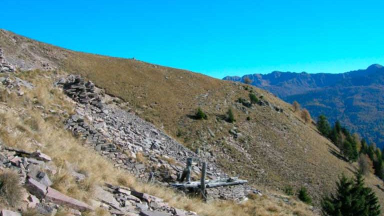
3 - Dosso di Costalta
5 km |
500 m |
2:00 |
E
View the route
Departure from loc. Parciocca with arrival at Dosso di Costalta after about 6 km with a positive altitude difference of 800m.
The Dosso di Costalta (1955 m) is the highest elevation of the watershed between the Pinè Plateau to the west and the Valle dei Mocheni to the east and constitutes the easternmost offshoot of the Lagorai. From its top you can enjoy the view of a breathtaking panorama with a 360 ° horizon that embraces different geological landscapes: from the Dolomite spiers of the Brenta Dolomites, a UNESCO World Heritage Site, to the gentle shapes of Monte Orno with metamorphic rocks of the crystalline base, to the harsh carbonate morphologies of Marzola and Vigolana to then range with a broad overview of the sections offered by the porphyry quarries of San Mauro and the Cembra Valley. In the 1950s, two mining activities were opened on the top part of the Dosso di Costalta, a few hundred meters away from each other: the Costalta di Miola quarry (in the municipal area of Baselga di Pinè, on the pinewood side) and the quarry of Costalta di Sant'Orsola (in the territory of the homonymous municipality, on the Mocheno side). In these quarries the porphyry was extracted and in situ the remains of the shacks used by the quarrymen can still be seen. Both in the quarry fronts and in the outcrop the porphyry is in a slab form: this characteristic which, together with its particular hardness, has allowed its widespread diffusion as a tile on the roofs of Trentino houses first and as a coating and flooring in the buildings and squares of the whole world then. The site can be reached from Passo Redebus by following the SAT path signpost E404 which from Passo Redebus climbs first Malga Pec, follows Malga Cambroncoi (agritur and restaurant) and then the last climb towards the destination of Cima di Costalta. The entire route is about 5 km long and the overall difference in height is 500 m for a travel time of about 2 h Other more challenging climbs, but equally satisfying for the beautiful views are: Miola for a length of about 8 km and a total height difference of 979 m and a travel time of about 3h, SAT path signpost E405 starting from S. Orsola for a length of about 5 km and a total height difference of 1000 m and a time of travel time of 3h.
back